August 2, 2024 — The National Weather Service’s Climate Prediction Center (CPC) released its monthly temperature and precipitation outlooks for August 2024 on July 31. The outlook favors above-normal temperatures across much of the contiguous U.S. (CONUS), with the highest probabilities exceeding 70% over central portions of the Interior West.
Various forecast models and guidance support this broad expanse of favored warmer-than-normal temperatures, including the 30-day European ensemble forecast and the 30-day weighted GEFS-CFSv2 temperature forecast. The 30-day European ensemble forecast predicts above-normal 500-hPa heights across practically all the CONUS, with larger height departures expected over the West.
Precipitation Outlook.
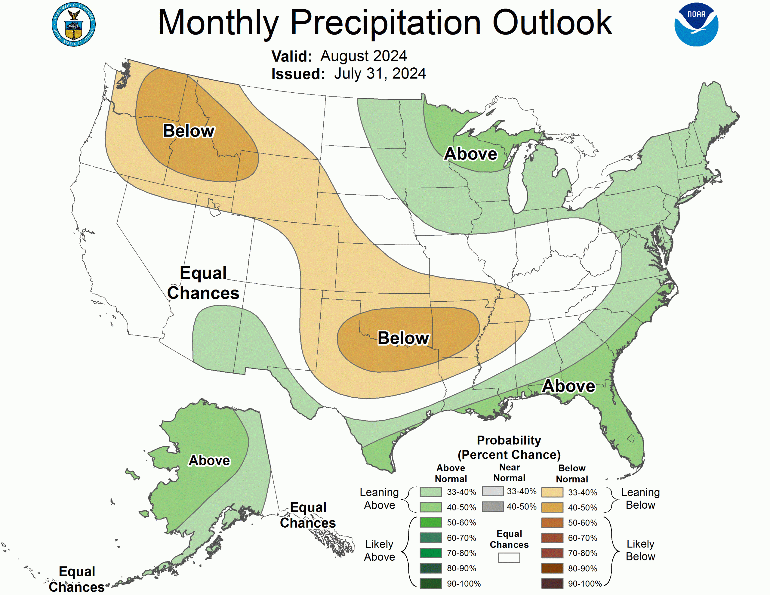
The precipitation outlook for August 2024 favors above-normal precipitation in the Four Corners region. This is based on several objective tools and considers a very active hurricane season in the Atlantic basin. Weak to moderate mid-level ridging centered over the northwestern CONUS favors a slight tilt in the odds towards above-normal precipitation for portions of the southern Four Corners states in the deeper easterly flow south of the mean ridge axis. These factors led to the Climate Prediction Center’s forecast of “a slightly enhanced monsoon” favored across this portion of the Southwest.


The randomness of the rains this summer have made me wonder if we are getting satisfactory saturation or not. I enjoy the thunder storms and look forward to them.